Mount Everest – 8,848.86 meters (29,031.7 feet) above sea level – holds an almost mythic place in the human imagination. Where exactly is Mount Everest? How does it sit within the tapestry of the Himalayas, and what does it mean to the people who live in its shadow? This long-form guide answers those questions and more: from Everest’s location on maps and borders to the local names, nearby peaks and settlements, access routes for travelers, and practical tips for anyone wanting to see the mountain – whether from a comfortable viewpoint or the rugged Base Camp trails.
Names of Mount Everest
Tibetan Names and Meanings
On the northern side, in Tibet, local people call the mountain Qomolangma (sometimes rendered as “Chomolungma”). In Tibetan, Qomo (or Chomo) means “goddess” and langma can mean “mother elephant” or “high mountain willow” — together interpreted as “Mother of the Earth” or a reverent goddess of the mountain. For Tibetans the name carries spiritual and cultural importance that predates modern surveying.
Nepalese Name and Meaning
On the southern side, in Nepal, the mountain is officially known as Sagarmatha, which translates to “Goddess of the Sky” in Nepali. This name was adopted in the 20th century as Nepal sought a distinctive local name rather than a foreign transliteration.
English Name and the Survey Legacy
The English name “Everest” honors Sir George Everest, the British Surveyor General of India in the mid-19th century who oversaw large-scale mapping of the Himalayas and the subcontinent. The name became widely accepted after survey work in the 1850s identified the peak as the highest on Earth and the mountain was officially named Everest in 1865 by the Royal Geographical Society.
Where Is Mount Everest in the World?
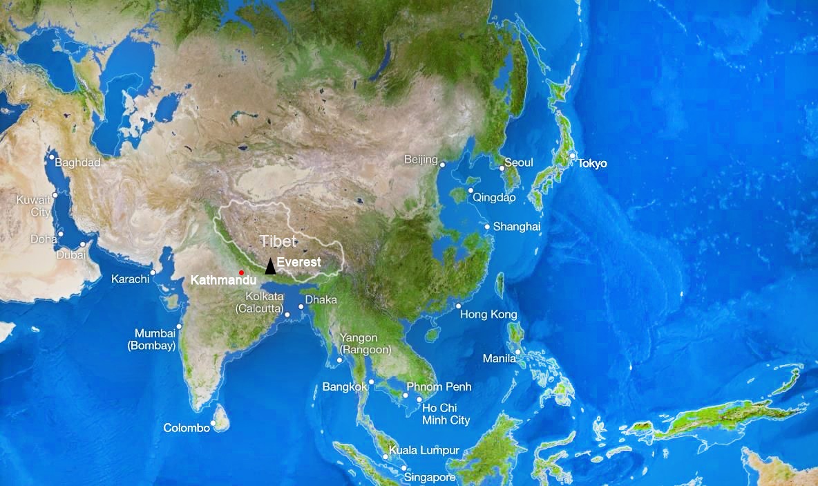
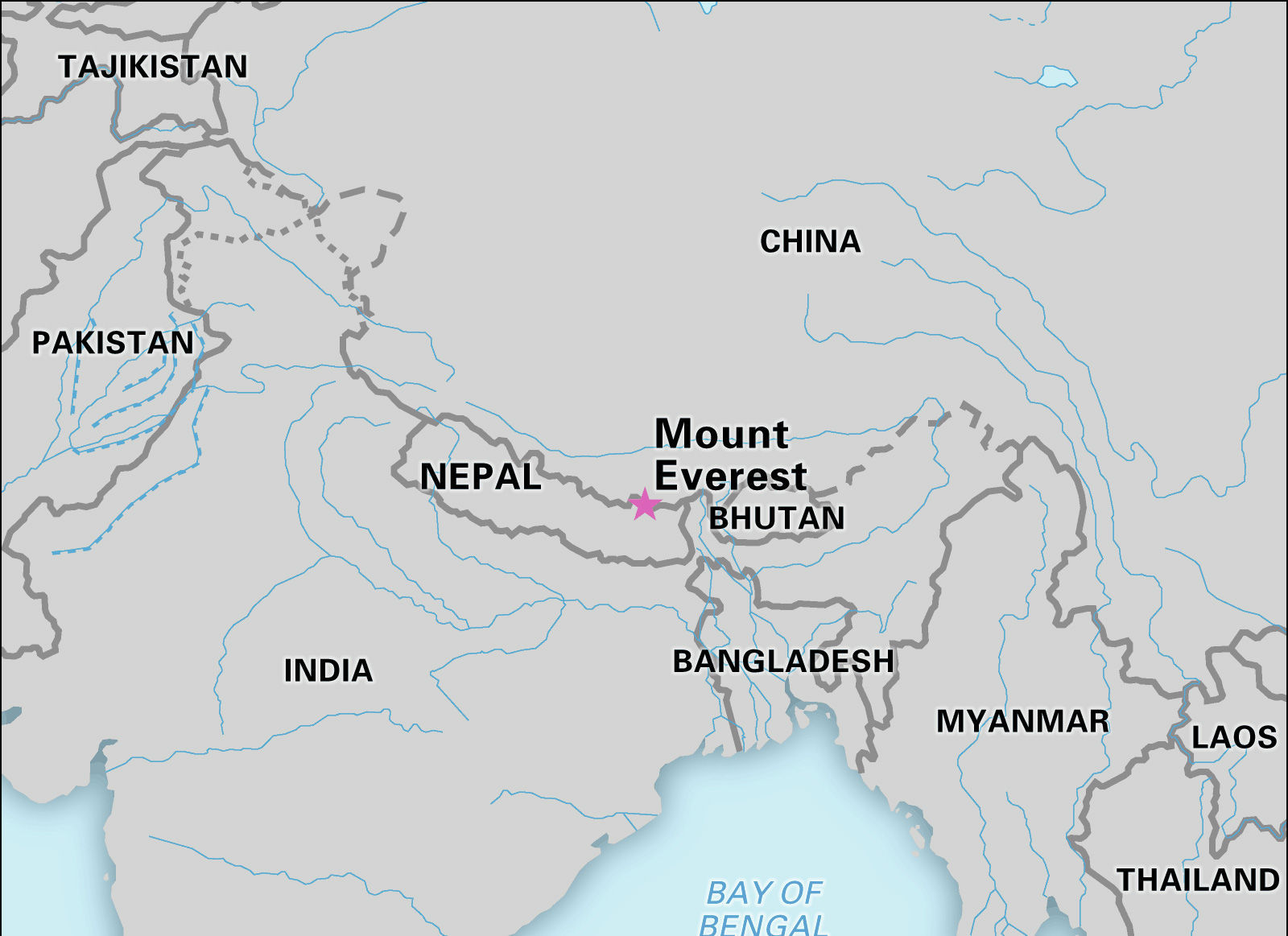
Mount Everest sits along the crest of the Himalayan range at the intersection of two great landmasses: the Eurasian continental plate to the north and the Indian subcontinent to the south. Geographically, Everest is located on the border between the People’s Republic of China (Tibet Autonomous Region) and the Federal Democratic Republic of Nepal. Its summit coordinates are approximately 27°59′15.85″ N latitude and 86°55′39.51″ E longitude — a precise point that crowns the Himalayan skyline.
Because Everest straddles an international border, the mountain belongs—geographically and culturally – to two regions simultaneously: Tibet to the north and Nepal to the south. That split identity shapes how people approach, name, and access the mountain.
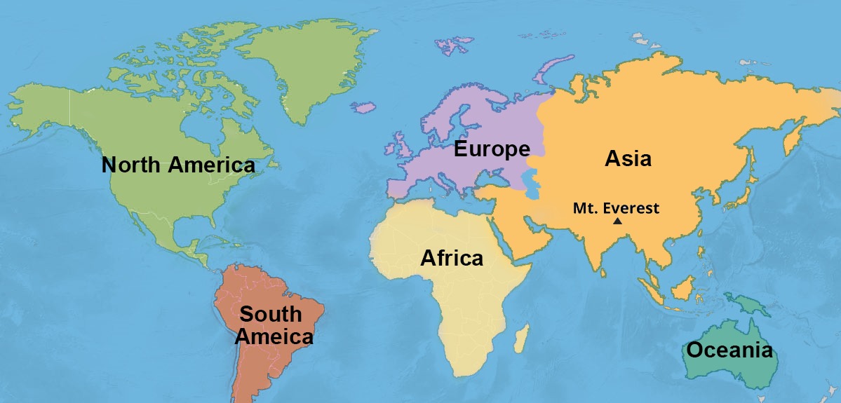
Map of Mount Everest in the world
Where Is Mount Everest within the Himalayan Range?
The Heart of the Himalayas
Everest occupies a central place in the Himalayas, a mountain system that stretches more than 2,400 kilometers across Asia with average elevations often above 6,000 meters. The Himalayas form a towering, continuous wall separating the Tibetan Plateau from the plains of the Indian subcontinent. Everest is part of the high central segment of this range and is surrounded by several other major peaks.
Neighboring Giants
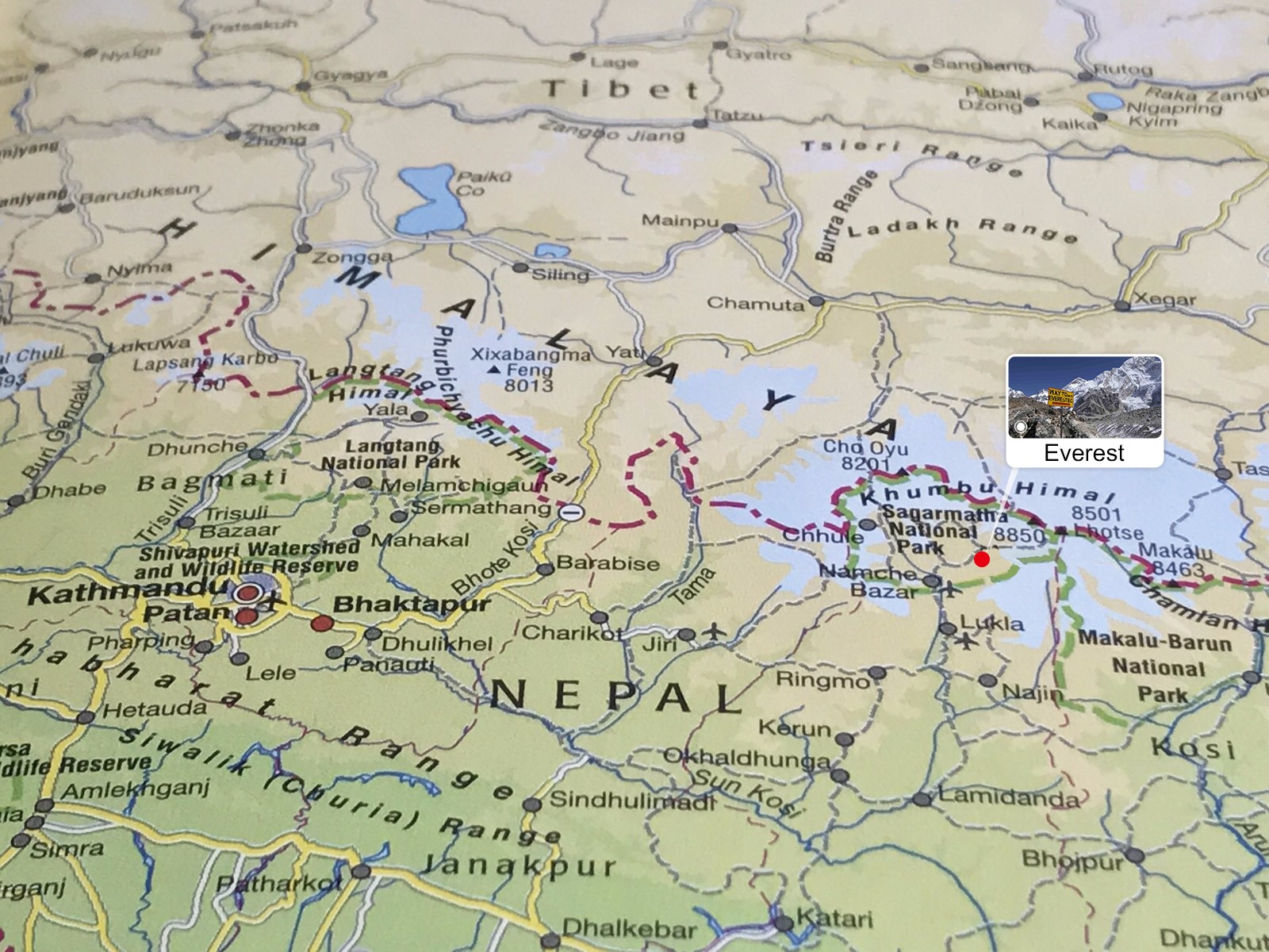
Within a few kilometers of Everest are other world-class peaks that form a dramatic cluster:
- Lhotse (8,516 m) — directly adjacent and the fourth highest mountain in the world.
- Nuptse (7,861 m) — a massive western neighbor seen prominently from south approaches.
- Makalu (8,463 m) and Cho Oyu (8,012 m) — among the nearby 8,000-meter giants of the central Himalayas.
This concentration of towering summits makes the Everest region one of the most spectacular high-mountain landscapes on Earth.
Mount Everest in the Himalayan mountain range
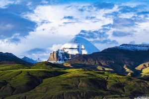
Where Is Mount Everest in Tibet?
Northern Slope and the Tingri Region
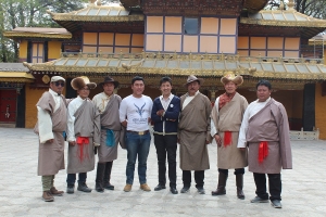
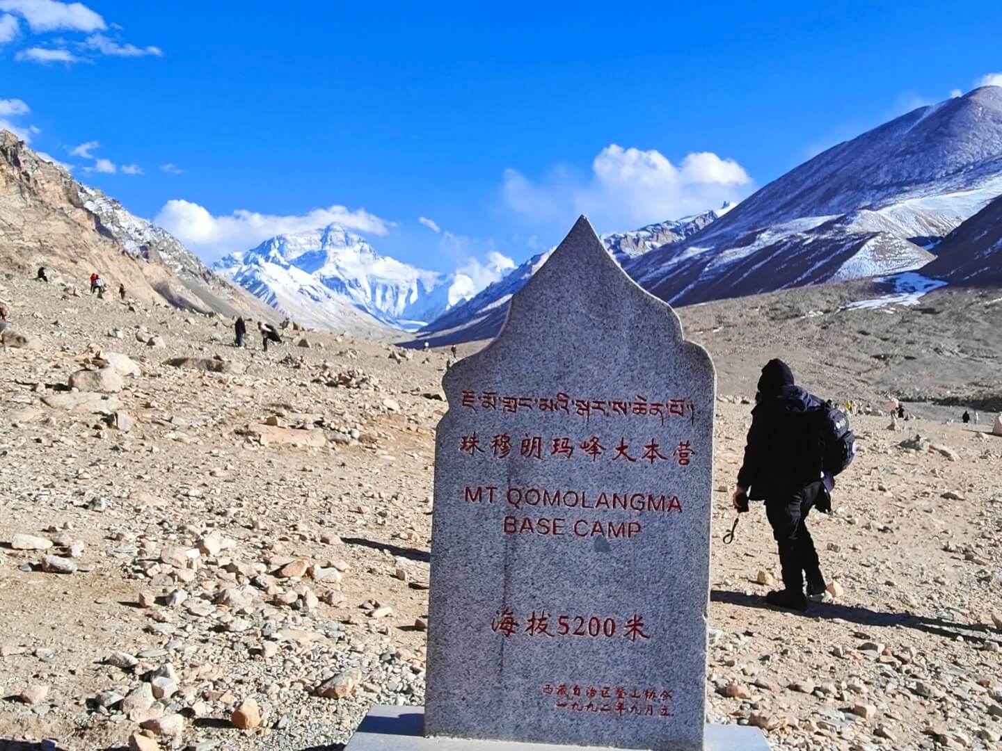
The northern slopes of Everest fall within Tingri County in the Tibet Autonomous Region of China. This is the route taken by climbers and trekkers approaching Everest from the north. The Tibetan side includes the famous Rongbuk Monastery, one of the highest monasteries in the world, and the Everest Nature Reserve, which protects the fragile high-altitude ecosystem.
The Everest Nature Reserve
China’s protected area around Everest is divided into functional zones—core, buffer, and experimental areas—with the “Everest Core Area” covering thousands of square kilometers. The northern landscape is stark and dramatic: high alpine deserts, glacial valleys, and broad high plateaus that frame the towering summit.
Base Camp and Trekking from the North
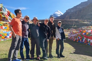
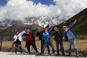
Tibetan-side access leads to the North Base Camp, which is reachable by road and short treks from nearby highland towns. The drive and approach offer unique panoramas of the mountain’s north face and a distinctly Tibetan cultural context — cloistered monasteries, yak caravans, and windswept high passes.
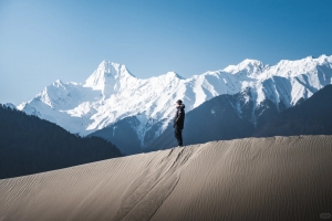
Mount Everest in Tibet
Where Is Mount Everest in Nepal?
Southern Slope and Sagarmatha National Park
On the southern side, Mount Everest lies within Sagarmatha National Park in Nepal’s Solukhumbu District. This UNESCO World Heritage site protects rugged mountain scenery, alpine ecosystems, and the Sherpa cultural homeland. The southern approaches are greener and more forested at lower elevations than the Tibetan north, with distinct villages, terraced fields, and rhododendron forests.
Everest Base Camp (South) and the Trekking Circuit
Nepal’s Everest Base Camp (South) is a world-famous destination for trekkers who prefer a trail-based, culturally rich approach. Typical treks begin with a flight into Lukla and climb through the Sherpa villages of Phakding, Namche Bazaar, and Tengboche before reaching the Base Camp area. The South Base Camp route is famous for its panoramic views, Sherpa hospitality, and classic Himalayan trekking experience.
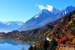
Mount Everest in Nepal
Nearby Cities and Villages – Where to Start Your Journey
On the Tibetan Side
- Tingri — the primary gateway town on the Tibetan approach, roughly 70 km from Everest’s base areas. It’s a logistical hub for northern expeditions.
- Rongbuk Monastery — perched near the Rongbuk Glacier, it’s historically and spiritually significant and the closest major settlement to the north face.
On the Nepalese Side
- Lukla — the small mountain airstrip town where most trekkers begin the Everest Base Camp trek; the short flight into Lukla is a classic element of the experience.
- Namche Bazaar — the bustling Sherpa trade town and acclimatization center for trekkers; it sits at around 3,440 meters.
- Kathmandu — Nepal’s capital and the primary international gateway for travelers heading to Everest; from here you can arrange domestic flights, permits, and guides.
How to Reach Mount Everest – North vs South Approaches
Northern (Tibetan) Route
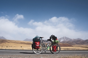
The Tibetan approach is typically overland from Lhasa or by road from other Tibetan towns. Vehicles can take you to high vantage points near Rongbuk and to northern base areas. This route offers dramatic views of Everest’s north face and access to Tibetan cultural sites.
Southern (Nepalese) Route
Most international trekkers and many climbers use the southern route via Lukla. The classic trek to Everest Base Camp (South) includes multiple days of walking, time for acclimatization, and a chance to experience Sherpa culture. Flights to Lukla operate from Kathmandu but can be weather-dependent.
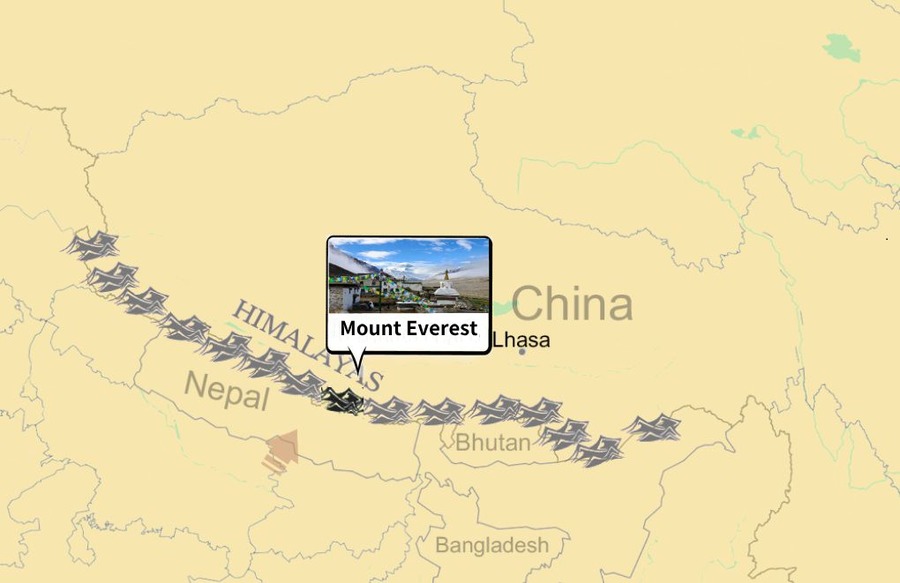
Map of Mount Everest and surrounding countries
Everest and Human History – Exploration and Ascents
Surveying the Highest Peak
European surveyors in the 19th century, working under the Great Trigonometrical Survey of India, established Everest as the world’s highest mountain during measurements made in the 1850s. The peak’s official height stayed a subject of study and occasional revision as surveying techniques improved.
First Successful Ascent
In 1953, New Zealander Sir Edmund Hillary and Nepali Sherpa Tenzing Norgay made the first confirmed successful ascent of Everest’s summit via the South Col route. Their achievement transformed Everest into a global symbol of human endurance and exploration.
Modern Climbing and Traffic
Since the first successful summit, Everest has become a major objective for mountaineers worldwide. Each year hundreds of climbers attempt the summit during the short spring climbing window; many succeed, some must turn back, and the mountain’s high altitude remains unforgiving. By early 2020 there were thousands of recorded summits — a reflection of both improved gear and organized expedition infrastructure.
Practical Information for Travelers: What to Expect
Altitude and Acclimatization
The Everest region lives at extreme altitude. Even Base Camps sit at very high elevations (South Base Camp is around 5,364 m / 17,598 ft; North Base Camp is lower or accessed differently). Proper acclimatization is mandatory for trekkers and mandatory safety practice for climbers.
Permits and Regulations
Both Nepal and China (Tibet) have regulatory systems requiring permits, local guides, and in many cases restricted access to certain zones. Trekking in Sagarmatha National Park, booking flights to Lukla, or entering the Tibetan plateau all need planning, paperwork, and often the assistance of a licensed local agency.
Best Times to Visit
The most popular windows for trekking and climbing are spring (April–May) and autumn (September–November) when weather conditions are relatively stable and views are often clear. Winter and monsoon seasons bring harsher weather and more difficult access.
Cultural Sensitivity
Everest is not merely a natural monument; it occupies sacred space for local communities. Respect for local customs, religious sites, and the environment is essential. Minimizing waste, using respectful photography practices around monasteries, and following local guidance are part of responsible travel.
Why Visit Everest – Beyond the Summit
Scenic and Cultural Riches
Mount Everest is as much about the journey as the summit. Treks to Base Camp offer immersive mountain cultures, the chance to stay in Sherpa villages, and dramatic landscapes from rhododendron forests to glaciers and alpine plateaus.
Wildlife and Natural Interest
Sagarmatha National Park and the Tibetan reserves are habitats for high-altitude species — from Tibetan antelope and snow leopard ranges in the broader region to rarer birds and the hardy domesticated animals of highland life, like yaks.
Photographic and Spiritual Experience
For many visitors, watching sunrise or sunset on Everest, visiting Rongbuk Monastery, and walking sections of the classic trekking routes are experiences of deep personal meaning, not merely checklist items.
Mount Everest
Where Is Mount Everest to You?
Geographically, Mount Everest sits precisely on an international border and at the highest point on Earth. Culturally and emotionally, Everest means different things to different people: a sacred mother goddess to Tibetans, the “Goddess of the Sky” to Nepalese, a milestone for climbers, and a breathtaking destination for travelers. Whether you see Everest from the north plateau of Tibet or walk the classic trails of Nepal’s Khumbu, the mountain offers a powerful reminder of scale, endurance, and the living cultures that have long called these high places home.
If you’re planning a trip to the Everest region and would like expert, travel-industry guidance — from permit assistance and acclimatization-friendly itineraries to culturally respectful sightseeing and safe trekking planning — Journey2tibet specializes in bespoke travel across Tibet and the greater Himalayan areas and can tailor an experience matched to your pace and interests. Contact Journey2tibet for routes, logistics, and guided programs that help you see where Mount Everest truly sits on the map — and what it feels like up close.