The Yarlung Tsangpo River is the longest river in Tibet and one of the most spectacular rivers in Asia. Flowing across the Tibetan Plateau from west to east, it passes through ancient valleys, Himalayan landscapes, and important cultural regions before becoming the Brahmaputra River in India. Known as the “Mother River of Tibet,” the Yarlung Tsangpo shaped Tibetan civilization for centuries and remains one of the best natural routes for travelers exploring Tibet today.
In this complete travel guide, you will learn where the Yarlung Tsangpo River begins and ends, why it is connected to the Brahmaputra River, what makes it geographically unique, and how travelers can best experience the river during a Tibet tour.
Yarlung Tsangpo River Facts
| Fact | Information |
|---|---|
| Length | About 2,900 kilometers |
| Source | Angsi Glacier near Mount Kailash |
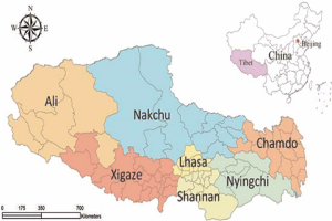
| Main Regions | Shigatse, Lhasa, Shannan, Nyingchi |
| End Destination | Bay of Bengal |
| Average Elevation | Over 4,000 meters |
| Famous Feature | Yarlung Tsangpo Grand Canyon |
| Importance | Cradle of Tibetan civilization |
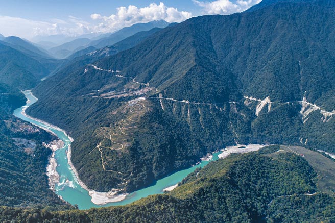
The Yarlung Tsangpo River Map in Tibet
The Yarlung Tsangpo River flows across southern Tibet, north of the Himalayan mountain range, forming one of the most important geographical corridors on the Tibetan Plateau. On a map of Tibet, the river stretches from the remote glacier regions of western Tibet toward the eastern Himalayas before turning south into India.
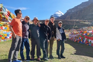
The river begins near the Angsi Glacier in Ngari Prefecture, close to the sacred Mount Kailash region. This high-altitude source lies among some of the most isolated and rugged landscapes in Tibet. From there, the river travels eastward across southern Tibet, passing through several important Tibetan regions including Shigatse, Lhasa, Shannan, and Nyingchi.
As the river continues east, the surrounding environment gradually changes. The dry landscapes and open valleys of western Tibet slowly transition into greener valleys, forests, and steep Himalayan terrain in southeastern Tibet. This geographical transformation is one of the reasons why the Yarlung Tsangpo River is considered one of the most diverse river systems in Asia.
After leaving Tibet, the river enters India through the eastern Himalayas, where it becomes known as the Brahmaputra River. It then flows through Bangladesh under the name Jamuna River before eventually reaching the Bay of Bengal.
This long transnational journey makes the Yarlung Tsangpo-Brahmaputra river system one of the most important waterways in South Asia, connecting high Himalayan glaciers with lowland plains thousands of kilometers away.
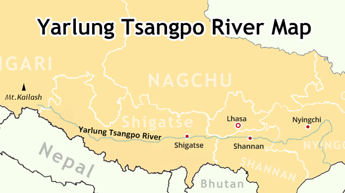
Yarlung Tsangpo River Map in Tibet
Geographical Features of the Yarlung Tsangpo River
The Yarlung Tsangpo River stretches for nearly 2,900 kilometers, making it the longest river in Tibet and one of the most significant rivers on the Asian continent. Its geographical diversity is one of its most remarkable characteristics.
The Highest Major River in the World
One of the most unique facts about the Yarlung Tsangpo River is its elevation. Much of the river flows at altitudes above 4,000 meters, making it the highest major river system in the world.
The river begins in glacier regions over 5,500 meters above sea level and experiences a dramatic elevation drop as it moves through southeastern Tibet. Over the course of its journey, the river descends by more than 5,000 meters, creating dramatic valleys, rapids, and deep canyons.
Three Main Sections of the River
Geographically, the Yarlung Tsangpo River inside Tibet is usually divided into three major sections.
Upstream Section
The upstream section extends from the glacier source in western Tibet to Lektse in Zhongba County of Shigatse. This area is characterized by dry landscapes, vast open valleys, glaciers, and sparse vegetation.
Midstream Section
The midstream section flows from Lektse toward Pai Village in Milin County of Nyingchi. This region includes many of Tibet’s most important farming valleys and historical cultural areas.
The Yarlung Valley in Shannan, considered the cradle of Tibetan civilization, is located within this middle section.
Downstream Section
The downstream section extends from Pai Village toward Motuo County in southeastern Tibet. Here, the river enters steep Himalayan terrain with deep gorges, dense forests, waterfalls, and subtropical ecosystems.
This part of the river features some of the most dramatic scenery anywhere on the Tibetan Plateau.
Diverse Ecosystems Along the River
Because the river travels through extremely different climates and elevations, the ecosystems along the Yarlung Tsangpo River vary greatly.
Travelers can see:
- High-altitude glaciers
- Dry plateau grasslands
- Fertile farming valleys
- Alpine forests
- Deep Himalayan gorges
- Waterfalls and subtropical vegetation
This environmental diversity supports a wide range of wildlife and plant species rarely found together in one river system.
Hydropower and Water Resources
In modern Tibet, the Yarlung Tsangpo River is also important for hydropower development and water resources. Several projects have been planned or developed along the downstream sections of the river to support energy production and infrastructure development.
Despite modernization, the river continues to remain deeply connected to Tibetan culture, agriculture, and daily life.
The Yarlung Tsangpo River Gorge Near Mount Namcha Barwa
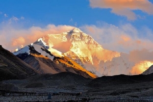
One of the most spectacular sections of the Yarlung Tsangpo River lies in southeastern Tibet near Mount Namcha Barwa. Here, the river cuts through towering Himalayan peaks and forms one of the deepest river gorges in the world.
The river passes between two enormous mountains:
- Mount Namcha Barwa
- Gyala Peri
Both peaks rise over 7,000 meters above sea level, creating an extraordinary landscape of dramatic elevation differences.
The Yarlung Tsangpo Grand Canyon
This section of the river forms the famous Yarlung Tsangpo Grand Canyon, often considered the deepest river canyon on Earth.
Unlike many canyons that exist in dry desert regions, the Yarlung Tsangpo Grand Canyon contains glaciers, snow mountains, dense forests, rivers, waterfalls, and subtropical vegetation all within a relatively short distance.
The extreme altitude differences create unique microclimates and ecosystems that attract researchers, photographers, hikers, and nature enthusiasts from around the world.
Why Travelers Love This Area
For many visitors, the Namcha Barwa region represents one of the most beautiful areas in Tibet.
The scenery combines:
- Snow-covered Himalayan peaks
- Massive river valleys
- Dense forests
- Fast-flowing rivers
- Hidden Tibetan villages
- Colorful seasonal landscapes
Autumn is especially popular because the forests around the canyon display vibrant golden and red colors against snow-covered peaks.
Photographers often consider this region one of the most photogenic places on the Tibetan Plateau.
Yarlung Tsangpo River
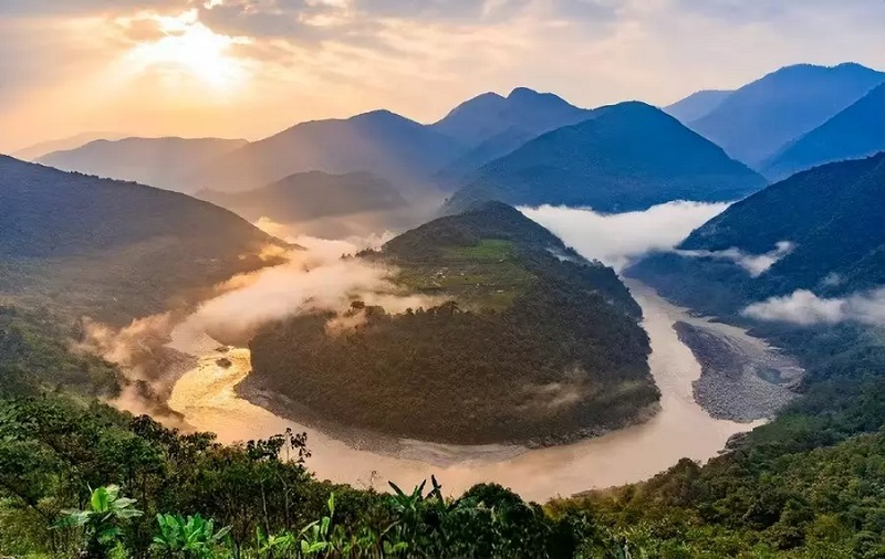
The Great Bend of the Yarlung Tsangpo River
Another famous geographical feature of the river is the Great Bend of the Yarlung Tsangpo River.
As the river approaches the eastern Himalayas, it encounters massive mountain ranges and changes direction dramatically. Over millions of years, the river carved through rising mountains and created sharp river bends surrounded by steep canyon walls.
The Zhaqu Great Bend
The most famous bend is the Zhaqu Great Bend near Mount Namcha Barwa in Nyingchi.
At this location, the river suddenly turns southward around the mountain, creating one of the most dramatic river curves in the world.
The scenery here includes:
- Deep canyon terrain
- Towering Himalayan peaks
- Rapid elevation changes
- Dense forests
- Powerful river currents
The Zhaqu Great Bend is widely regarded as one of Tibet’s greatest natural wonders.
Other Famous River Bends
Several additional bends can also be found in southeastern Tibet, especially in Motuo County.
These include:
- Guoguotang Great Bend
- Linduo Great Bend
Each section offers different landscapes ranging from wide valleys to narrow canyon passages surrounded by forests and snow mountains.
A Paradise for Nature Lovers
Today, the Great Bend region is popular among:
- Photographers
- Adventure travelers
- Nature lovers
- Landscape enthusiasts
Viewpoints near Namcha Barwa offer breathtaking panoramic views of winding rivers and Himalayan scenery that are unlike anywhere else in Tibet.
The Yarlung Tsangpo River and the Brahmaputra River
Many travelers wonder whether the Yarlung Tsangpo River and the Brahmaputra River are the same river. The answer is yes.
The Yarlung Tsangpo River is simply the Tibetan upper course of the Brahmaputra River system.
Different Names Along the Journey
As the river flows through different countries, it changes names.
| Region | River Name |
|---|---|
| Tibet | Yarlung Tsangpo River |
| India | Brahmaputra River |
| Bangladesh | Jamuna River |
Although the names change, the river itself remains part of one continuous water system stretching from the Tibetan Plateau to the Bay of Bengal.
One of Asia’s Most Important Rivers
The Yarlung Tsangpo-Brahmaputra river system is one of the most important transboundary rivers in Asia.
It supports:
- Millions of people
- Agricultural regions
- Diverse ecosystems
- Ancient civilizations
- Transportation and trade routes
The river’s journey from Himalayan glaciers to tropical lowlands also makes it one of the most geographically fascinating waterways in the world.
Yarlung Tsangpo River
Why Is the Yarlung Tsangpo Called Tibet’s Mother River?
The Yarlung Tsangpo River is often called the “Mother River of Tibet” because it played a crucial role in the development of Tibetan civilization.
The Cradle of Tibetan Civilization
The fertile Yarlung Valley in Shannan, located along the middle reaches of the river, is widely considered the birthplace of Tibetan culture.
Early Tibetan farming communities developed here because the river provided water, fertile land, and suitable conditions for agriculture.
Over time, these settlements grew into important political and cultural centers.
The First Tibetan Kingdom
According to Tibetan tradition, Nyatri Tsenpo, regarded as the first Tibetan king, established his kingdom in the Yarlung Valley.
This region later became one of the most influential centers of the early Tibetan Empire.
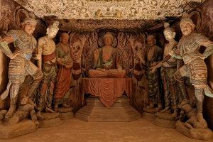
Yumbulakang Palace
One of the most famous historical landmarks in the Yarlung Valley is Yumbulakang Palace, traditionally believed to be the first palace built in Tibet.
Standing above the valley, the palace symbolizes the origins of Tibetan kingship and remains one of the most important historical sites in Tibet.
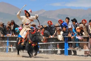
Cultural and Spiritual Importance
For centuries, the Yarlung Tsangpo River supported:
- Farming communities
- Trade routes
- Monasteries
- Tibetan towns
- Religious development
Many famous monasteries and ancient settlements were established near the river because it served as a lifeline across southern Tibet.
Even today, the river remains deeply connected to Tibetan identity and cultural heritage.
Best Ways to Experience the Yarlung Tsangpo River in Tibet
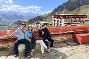
The Yarlung Tsangpo River passes through many of Tibet’s most scenic and culturally important regions, making it one of the best natural routes for travelers exploring Tibet.
Tibet Overland Tours
Traveling by road is one of the best ways to experience the changing landscapes along the Yarlung Tsangpo River.
Many overland travel routes in Tibet follow sections of the river, allowing travelers to witness dramatic scenery changes from open farming valleys to dense Himalayan forests.
The route between Shigatse and Lhasa along the G318 National Highway is especially scenic. The road frequently runs beside the river and offers excellent panoramic valley views.
This type of journey is ideal for travelers who prefer:
- Flexible sightseeing
- Photography opportunities
- Slower travel experiences
- Scenic road trips
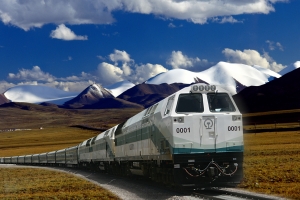
Tibet Train Tours
The Tibet railway system also offers impressive views of the Yarlung Tsangpo River.
Train routes from:
- Lhasa to Shigatse
- Lhasa to Nyingchi
pass through beautiful river valleys, grasslands, and mountain landscapes.
Travelers can often see the river directly from train windows, especially while crossing bridges such as the Zangmu Yarlung Tsangpo River Bridge in Shannan.
Train travel is perfect for visitors seeking:
- Comfortable transportation
- Relaxed sightseeing
- Scenic journeys across Tibet
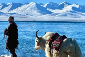
Ferry Crossings and Riverside Experiences
In some regions, travelers can also experience local ferry crossings on the Yarlung Tsangpo River.
One popular example is the ferry route near Samye Monastery in Shannan. Travelers can cross the river from the southern bank near Tsedang and continue toward one of Tibet’s oldest monasteries.
This slower travel experience allows visitors to enjoy:
- Traditional riverside life
- Peaceful valley scenery
- Rural Tibetan villages
- Authentic local culture
Best Places to See the River
Some of the best locations to experience the Yarlung Tsangpo River include:
- Yarlung Valley in Shannan
- Lhasa river valleys
- Nyingchi forests
- Namcha Barwa viewpoints
- Yarlung Tsangpo Grand Canyon
- Motuo County
Each region offers completely different landscapes and travel experiences.
Best Time to Visit the Yarlung Tsangpo River
The best time to visit the Yarlung Tsangpo River is generally from April to October.
During this period:
- Temperatures are warmer
- Weather conditions are more stable
- Roads are more accessible
- Landscapes are greener and more colorful
Spring
Spring brings fresh greenery and blooming flowers to the valleys of Shannan and Nyingchi.
Summer
Summer offers lush forests and stronger river flows, especially in southeastern Tibet.
Autumn
Autumn is often considered the most beautiful season because of clear skies, colorful forests, and excellent mountain visibility around Namcha Barwa.
Winter
Winter is colder but offers quieter travel experiences and snow-covered landscapes in central Tibet.
Travel Permits for Foreign Travelers
International travelers visiting Tibet must obtain a Tibet Travel Permit before entering Tibet.
Certain areas along the Yarlung Tsangpo River, especially remote sections in southeastern Tibet or border regions, may also require additional permits.
Because permit regulations can vary depending on the travel route, it is highly recommended to arrange Tibet travel through an experienced local Tibet travel agency.
Journey2tibet helps international travelers arrange Tibet permits, transportation, accommodations, and customized Tibet tours that include scenic sections of the Yarlung Tsangpo River.
Discover the Heart of Tibet Along the Yarlung Tsangpo River
The Yarlung Tsangpo River is far more than a geographical feature. It is the lifeline of southern Tibet, the birthplace of Tibetan civilization, and one of the world’s most spectacular river systems. From the glaciers of western Tibet to the deep Himalayan canyons near Mount Namcha Barwa, the river reveals an incredible variety of landscapes, cultures, and ecosystems that define the Tibetan Plateau.
For international travelers, exploring the Yarlung Tsangpo River offers a deeper understanding of Tibet itself. Ancient valleys, sacred monasteries, dramatic mountain scenery, and remote Tibetan villages all come together along the river’s course, creating one of the most unforgettable journeys in Asia.
Whether you choose an overland adventure, a scenic Tibet train journey, or a cultural exploration through the Yarlung Valley, the Yarlung Tsangpo River provides a unique window into Tibet’s natural beauty and historical heritage.
If you are planning a Tibet journey, Journey2tibet can help you explore the most scenic and culturally important regions along the Yarlung Tsangpo River with professional local support, Tibet permits, and carefully designed travel experiences tailored for international visitors.